The quick road to an own datamodel
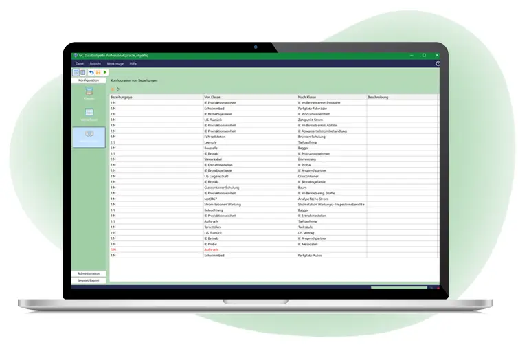
GC Oracle Objekte is a powerful tool that enables Smallworld users to create own datamodels in an open architecture and without programming. Data model standards won`t be changed and updates aren`t affected.
GC Objekte Professional with PostGIS support released
GC Oracle Objekte, the produkt that is used by over 50 Smallworld customers to model own objects in Smallworld GIS, quickly supports in the newest version not only the Oracle-data base but also the open-source-data base PostGIS, too.
This product is released in march 2024 during our event GC Tage and is called GC Objekte Professional as of now.
The large functions and design surface within the Smallworld GIS surface are now available for both data bases.
Expecially with the open-source data base PostgreSQL with the PostGIS application are designed data in this open data base structure immediately available, for example in QGIS or other systems. The PostGIS data base can also be used in a containerization in cloud computing.
Create your own object classes
You can create your missing object classes in your own Smallworld application within a few minutes.
All data formats
You can use all Smallworld data formats for GC Objekte Professional (selection fields, date, integers, decimals, catalog fields, strings).
Various geometries
GC Objekte Professional enables to use point, line, surface and text geometries. You can open the geometries next to the presentation in the main window for spatial analysis and individual styles.
More features:
- Logical fields and triggers: You can define logical triggers and fields for individual attribute fields. Furthermore, you can use Magik-programming-codes for complex tasks.
- Relations: The created Oracle objects can be related among each other and with data model objects from Smallworld. Simple and multiple relations are easily possible. This enables to create own data models and to complete existing data models via missing object classes.
- Compound documents: GC Objekte Professional supports standard compound documents from Smallworld GIS. It enables to deposit files like PDF, Word or Excel files.
- Editor: The order and structure of object class attributes can be defined freely within the editor.
- Free Oracle databases: GC Objekte Professional can use different Oracle databeases including the free Oracle XE-database.
- Inheritance: Within the created objects an inheritance could be performed. This enables you to use a basic configuration for similar objects.
- Location integration: Different location models can be used as attributes directly, for example the ALKIS location. You get direct access to the particular tables.


